


http://blog.csdn.net/scy411082514/article/details/7485064
先看幾個比較重要的名詞:
Tiles
Tiles are rectangular slabs of ceramic affixed in a grid arrangement to your bathroom wall! But here we're much more likely to be talking about map tiles: square bitmap graphics displayed in a grid arrangement to show a map. We may also be talking about tiled map data (described below)
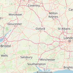
網上有的翻譯爲瓦片,個人理解爲地圖切片。簡單的說,就是把一張大大的地圖,分割成許多小正方形(如下)。這樣在加載地圖的時候,只需要把區域內相關的小正方形加載出來就可以了。

http://tile.openstreetmap.org/7/63/42.png
(格式:[Url]http://tile.openstreetmap.org/{LEVEL}/{ROW}/{COL}.png[/Url])
如上圖,Map tiles 通常是256 x 256 像素的,雖然這不是一定的,但由於Google Map的影響,這其實已成爲實際的標準。
WMS
WMS 爲 Web Map Service的縮寫. 它是符合 OGC 標準的HTTP上的地圖圖像服務。
Routing
Routing(或navigation),通常稱之爲導航。OpenStreetMap爲駕車、步行、騎車、騎馬等方式均提供了導航信息。目前已有許多離線的、嵌入的、或者基於網絡的使用OpenStreetMap數據的導航服務。
Rendering
Readering:通過原始的地理數據渲染出可視化地圖的過程。通常,這個過程還可以包含圖像的繪製、地圖切片的製作或者矢量、3D類型地圖的製作。
一些地圖渲染的軟件可參看這裏:http://wiki.openstreetmap.org/wiki/Rendering